Altered Geography of Skyrim and Solstheim
There is much to suggest that TES V was primarily designed for newcomers to the TES series and casual players. While traversing the province, players become familiar with the land and its geography, and gradually, some no longer require a quest marker, signposts, or a map to reach their destinations. Scarcely anyone has a reason to ponder the topography or to question it in any way.
However, much like in Cyrodiil, Bethesda redistributed the most important and quest-relevant locations so that they cover the land evenly and fit the new quests. No one notices this while playing, as no one visited Skyrim prior to TES V.
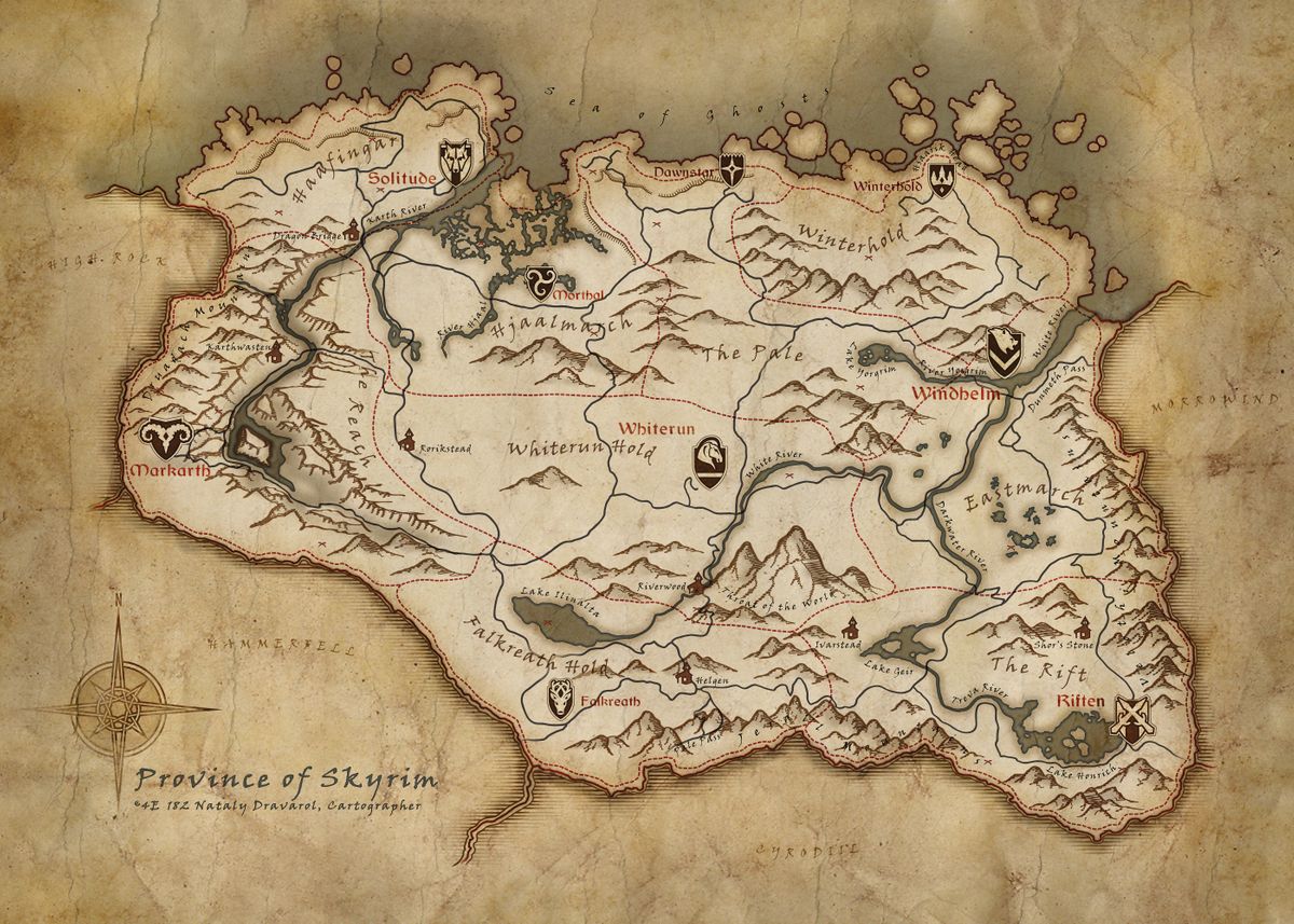
No one? Not quite. Players who experienced TES I: Arena were able to travel through Skyrim nearly 250 years ago and are now at least astonished. Some geographical locations were altered so drastically for TES V that one might think Bethesda does not take the players seriously (or believes that the Arena players have died out in the meantime). Perhaps this is why the included brown paper map of Skyrim is a mixture of the original Arena world and the GPS-like in-game map of Skyrim.
- Windhelm: Formerly situated nearly at the coastline and the border to Morrowind, it has now been relocated southwest into the interior of the province. This was done to ensure even distribution and prevent it from being positioned too close to Winterhold.
- Markarth: Previously located more centrally in the west, it effectively swapped positions with Karthwasten. Where Markarth stands today, Karthwasten was located in the past - and vice versa.
- The Pale: The region designated today as the Hold of The Pale was formerly named Northshore. The actual territory named "The Pale" was originally situated further south, nestled between the territories of Falkreath and The Rift. A prominent remnant of this original layout is the "Pale Pass," which Bethesda could neither rename nor relocate due to pre-existing lore.
- High Hrothgar: The mountain was previously situated west of Labyrinthian. For TES V, the mountain was shifted eastward, positioning it near Riverwood.
Bethesda performed similar alterations to the island of Solstheim within the Dragonborn add-on. However, the modifications on Solstheim are considerably more noticeable, given that TES III: Morrowind (Bloodmoon) is not as distant in the past as TES I: Arena, and a larger volume of players are capable of remembering the original layout.
The alterations in the geography of Solstheim can largely be explained by the catastrophe on neighboring Vvardenfell. For 200 years, Red Mountain has been spewing fire and ash into the sky, which manifests as ash storms and precipitation on Solstheim. The modifications that immediately catch the eye of a Bloodmoon player are the following:
- The southern district of the island is almost entirely covered with ash. The former forests and vegetation have burned away, and scarcely anything grows anew.
- The Iggnir River formerly originated from Lake Fjalding near Thirsk and flowed south to the sea. Today, it is fed by the melted snow of the Isinfier Plains and has been reduced to little more than a shallow stream.
- Lake Fjalding has shrunk to half its original size.
- The sources of the Harstrad River were previously located in the center of the island. Today, the river originates from a melting glacial ice cave and is shortened to a fraction of its former length.
- The melting glacial masses have evidently also reshaped the land in the north and shifted it eastward, where new small islands have also formed.
- Two to three dozen caves and barrows are buried or collapsed, rendering them no longer accessible. No traces of them can be found anymore.
- Despite being closest to the active volcano, the Felsaad Coast has remained largely unaltered.
Mortrag Peak marks a mountain summit in the area where the vast Mortrag Glacier was previously situated. Just 210 years prior, it blanketed an extensive Daedric cult site dedicated to either Mehrunes Dagon or Molag Bal. Hircine utilized these historical structures to host his famous Hunt, which was foretold within the Bloodmoon Prophecy. The glacier subsequently collapsed and potentially melted slowly due to the volcanic eruption on Vvardenfell, meaning it can no longer be perceived as such today.
Furthermore, extensive Dwemer ruins are encountered today, which appear to have been partially excavated and partially exposed by ice and water. New caves, camps, mines, and ancient burial sites can also be found. Naturally, much has been oriented toward dragons once again, and the main quest line revolves around nothing else. Here, it is clearly discernible that the entire dragonization was ruthlessly forced into the lore, given that not a single reference to dragons existed just 200 years prior.
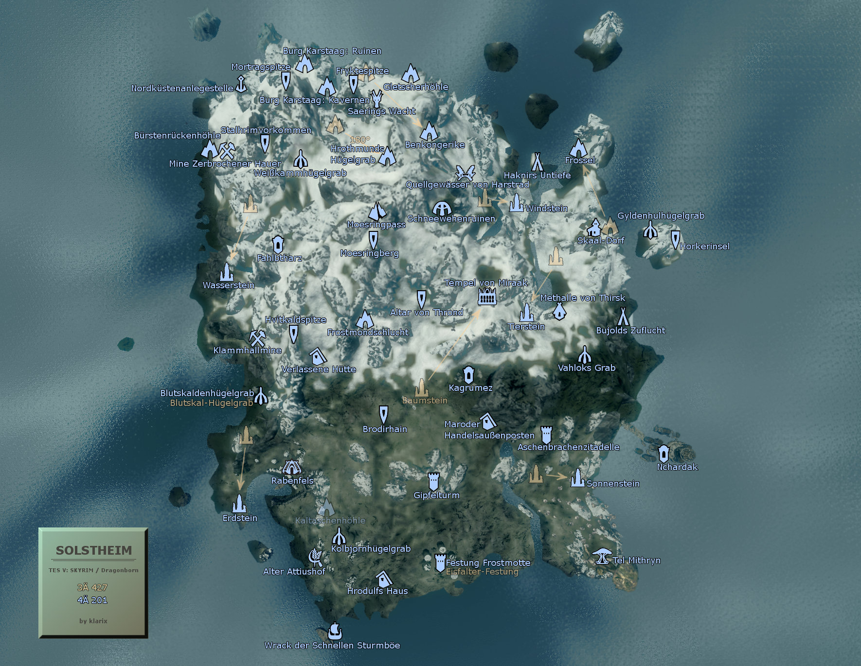
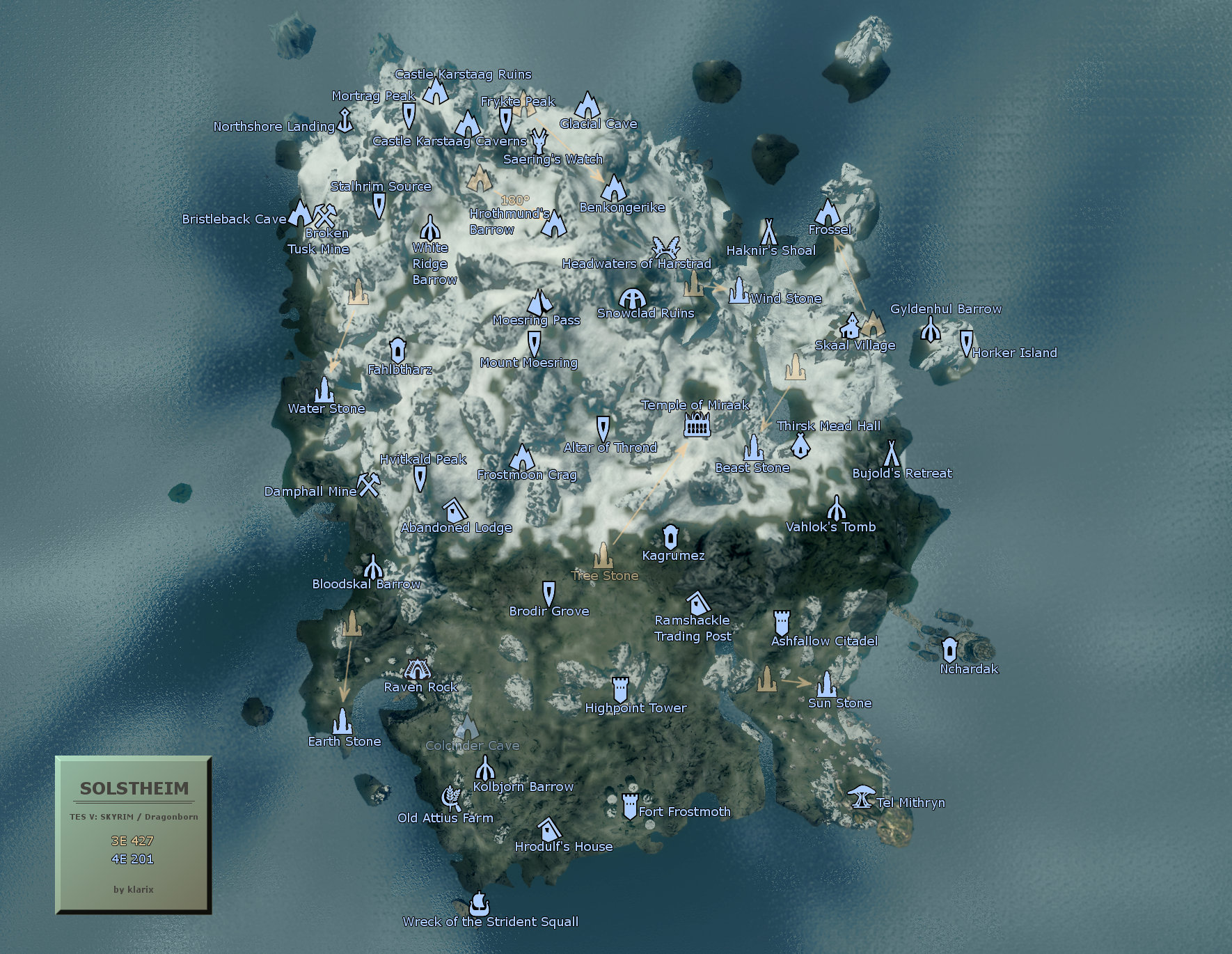
Upon closer inspection of Solstheim's geography, unusual circumstances are discovered (almost as expected) that cannot be explained by time, nor by climatic or tectonic changes. For instance, certain caves have altered their locations, and Hrothmund's Bane has now been rotated by 180 degrees (a manifestation of sheer dilettantism). The fact that the crashed airship is now situated in an entirely different location could potentially be attributed to Riekling activity. However, what remains truly astonishing is that all the All-Maker Stones stand in different locations now. This is genuinely difficult to explain, particularly since cave entrances were partially situated at their current locations in the past.
To illustrate these points, a map has been created (available in both German and English) that highlights the most significant changes:
↑ klarix (23.02.2013)